


Basics
- Length:
- 480 miles (772 km)
- Time:
- Nine hours to drive (including backtracking) or six days to enjoy the Byway.
- Fees:
- There is an admission fee to enter some areas including National Parks.
Description
The Trail of the Ancients takes you back to a time long before the United States existed, long before Spaniards came north from what is today Central America. Amazingly, some regions of the Colorado Plateau remain today much as they must have been in the 13th and 14th Centuries. Arid and mostly uninhabited, the terrain along the Trail conceals secrets of bygone populations, vibrant people who came and went like snow in warm spring sunshine or tumbleweeds at the front of a desert storm. The Trail travels through some of our country's most beautiful yet austere country, and lends itself to contemplation and rejuvenation as well as recreational adventures.
Though desolate now, people have lived around the Trail of the Ancients from at least 10,000 BC. They sustained themselves by hunting game and gathering food plants. The Ancestral Puebloans entered the scene later and occupied the Four Corners area from around AD 1300. Their life revolved around settled communities and horticulture. At numerous stops along the circuitous Trail today, ruins and other cultural elements -- tools, pottery shards, petroglyphs, and pictographs -- serve as rich reminders of these ancient peoples.
There are over 4,000 known archaeological sites in Mesa Verde National Park alone, 600 of which are cliff dwellings. Mesa Verde tells the story of a civilization's dynamic growth over 700 years. Hundreds of homes and villages within the park's boundaries are over eight centuries old. Preserved and protected by overhanging cliff ledges, their beauty and complexity speak eloquently of the ancient people who built them. They lend an almost haunting feeling of isolation to your visit, while encouraging you to imagine burgeoning communities, bustling with people and activity. Walk into Long House or climb ladders into Balcony House and hear the wind whispering through the shadowed rooms. Villages and farming areas once dotted the mesas of the park. Cliff dwellings were built in the canyons long after underground pit houses first appeared on the mesa tops. The mesa's entire human history is captured in these park sites.
At the Anasazi Heritage Center in Mesa Verde National Park, you'll be invited to interact with history. The Center takes the experience of the Four Corners into the personal realm with interactive exhibits. Discover the Ancestral Puebloan history through a pit house replica, films, and interactive experiences. See traditional dances with the Hopi or Zuni people, grind corn on a metate stone with a mano (another stone), weave on a traditional loom, or experience virtual archaeology using computer programs designed for all ages. With diverse activities to satisfy and educate for days, the Center highlights the Pueblo, Ute, and Navajo life ways, both past and present.
The Trail of the Ancients has more to offer than archaeology. Take a day to float down the San Juan River. At Natural Bridges National Monument you can take pictures of three huge sandstone bridges. Backpack or ride horseback into the Grand Gulch Primitive Area, or stand in four states at once (Utah, Colorado, New Mexico, and Arizona) at the Four Corners Monument.
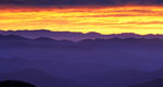
The native people knew how to choose a neighborhood! Their "backyard" is diverse and breathtaking. Monument Valley, in Utah, was John Ford and John Wayne's favorite movie location. As John Wayne said, "This is where God put the West." Monument Valley is the West at its finest, with huge vistas, marvelous sunsets, bright red and orange sandstone of any shade Georgia O'Keefe or Henry Matisse could ever desire. The individual is dwarfed in the shadow of such natural grandeur. What is this place where Native Americans have survived and thrived in centuries past; where it rains just a handful of inches a year; where the ecosystem is fragile and fierce?
Seasons and people, flora and fauna come and go, human cultures shifting and ecosystems adapting. The nature of a desert preserves the past and blends familiar whispers of the area's ancient inhabitants with today's sandy winds. After the Ancestral Puebloans, both Ute and Navajo Indians settled in the area, enriching the cultural traces that can be found by today's tourist along the entire Byway. With this spectacular backdrop, the Trail of the Ancients offers a vacation and an education.
Points of Interest
Points of Interest Along The Way
Anasazi Heritage Center (CO)
The Anasazi Heritage Center is a museum interpreting the history and culture of the Canyons of the Ancients National Monument, Trail of the Ancients, and the Four Corners region. The museum curates more than 3.5 million artifacts from southwest Colorado. The center's Hands-On Discovery Area, education programs, permanent exhibits, and films explore the archaeology and history of the area as well as the cultures of the Pueblo, Ute, and Navajo Indians. Artifacts from southwest Colorado are on display. The Escalante and Dominguez Pueblos are accessible at the center.
Bluff (CO)
Bluff was established in 1880 by the Hole-in-the-Rock Mormon Pioneers. The original fort is still standing, and the community is dotted with Victorian era sandstone homes. The historic cemetery shares a hilltop with an ancient Pueblo site. People have lived on this site for hundreds of years, and the modern population is an interesting mixture of Anglo and Navajo, bespeaking the town's rich past.
Butler Wash Indian Ruins (CO)
Directly off Utah Highway 95, this small cliff dwelling is signed with a parking area provided. A foot trail winds across small washes and over sandstone "slickrock" to an overlook of the dwelling half mile across a small canyon. Interpretive signing is located at the overlook.
Canyons of the Ancients National Monument (CO)
Covering almost 164,000 acres of high desert and steep canyons, this area contains more than 5,000 recorded archaeological sites, the highest known archaeological site density in the United States. Some of the ancient structues retain standing walls, and many others are merely piles of rubble. Humans have lived in this area for at least 10,000 years, from the early Basketmakers through today's residents.
Directions
From Colorado: 10 miles south of Dove Creek along Dolores County Road 6 (approx. 1 hour); 4 miles west of Cahone via Dolores County Road R (approx. 1/2 hour); 11 miles west of Pleasant View along Montezuma County Road CC (approx. 1 hour), also 5 miles west of Pleasant View via Montezuma County Road BB then 2 miles south along Montezuma County Roads 12 or 10 (approx. 1 - 1 1/2 hour); 2 miles west of Yellow Jacket via County, Road X then 5 miles south along County Road 15 then 2 miles west along Montezuma County Road U (approx 1 hour); 1 and 1/2 miles south of Arriola on US Highway 491, then 10 miles west along Montezuma County Roads P and N (approx. 1 hour); 5 miles south of Cortez along US 491 to the junction with Montezuma County Road G, then along Road G 44 miles to the Utah border and San Juan County Road 402 (about half way from either Colorado or Utah is the Sand Canyon Trailhead) [approx. 1 1/2 hour]., From Utah: 15 miles east of Bluff via US Highway 163 to Montezuma Creek then 7 1/2 miles west of Montezuma Creek via Utah Highway 262 to Aneth then 24 miles north via San Juan County Roads 402, 401, 413, and 213 to connect with the western end of Montezuma County Road 10 noted above (approx. 1 1/2 hour). Also from Bluff, 15 miles east via US Highway 163 to Montezuma Creek, then 7 1/2 miles west of Montezuma Creek via Utah Highway 262 to Aneth, then 13 miles north and east via San Juan County Road 402 to the Colorado border where the road becomes Montezuma County Road G (approx. 1 1/2 hour either way).
Cortez (CO)
The Navajos called Cortez Tsaya-toh, meaning rockwater. The spring that once provided water for Navajo sheepalso attracted ranchers to the area, then known as MitchellSprings. The name of the town was changed when Cortez was foundedin 1886 and moved a short distance north to the present day townsite. Ranching and farming became the economic mainstay of Cortez,and the town also became a major trading center for NativeAmericans.
Today you may still catch a cattle drive in the spring or fall,or join in the Ute Mountain Rodeo every June. Junior Rodeo eventsare held at the Fairgrounds throughout the year and the MontezumaCounty Fair, held each August, is a showcase for the farming andranching life that is still very much a part of the community.Navajos and Utes continue to come to Cortez as they did in the late1880s and their artwork may be found in the many quality tradingposts throughout Cortez. In the summer Indian Dances and culturalprograms are offered six nights a week at the Cortez CulturalCenter, and many community events are held throughout theseason.
Historic buildings in the downtown area are part of theCrossroads Culture Walk, an interesting way to discover the uniquehistory of the area, and learn how Cortez has been a merging pointand trade center for many cultures for well over 2000 years.
Dolores (CO)
The valley's first settlement in 1877 was at Big Bend, about 1.5miles downstream from today's town of Dolores. Big Bend wasabandoned when the Rio Grande Southern Railroad route was scheduledto bypass the settlement, and residents moved next to the tracks atDolores' present town site. The Galloping Goose railcar and museumstands only feet from the spot where the railroad once ran.
Dolores is home to McPhee Lake, the second largest body of waterin Colorado, offering a variety of boating and recreationalactivities. The San Juan/Rio Grande National Forest, at Dolores'doorstep, offers great outdoor activities, including camping,hiking, hunting, and winter sports. The Dolores River and McPheelake offer great fishing, and the Dolores River providesopportunities for kayaking and rafting.
Dolores is also home to the Anasazi Heritage Center, a uniquefederal museum, research center and curation facility, andheadquarters for the new Canyons of the Ancients National Monument.The town of Dolores lies on the San Juan Skyway, a state andfederally designated scenic Byway, called "America's Most BeautifulDrive." Annual celebrations in Dolores include Escalante Day inAugust and Christmas in Dolores during December.
Edge of the Cedars State Park and Museum (CO)
The displays in southeast Utah's only formal archaeological repository house depict both the ancient Pueblo culture and more recent cultures of southeast Utah. Visitors are encouraged to tour the Pueblo ruin and wander among the exquisite displays inside the museum. Visible storage allows visitors to see those objects ordinarily stored out of sight. The museum has the largest display of prehistoric Puebloan pottery in the Four Corners region.
Lowry Pueblo (CO)
Excavated in the 1930s, Lowry Pueblo was dedicated as a National Historic Landmark in 1967. It is a 1,000-year-old Ancestral Puebloan village built around AD 1060 and inhabited for about 165 years. The ruin contains a Great Kiva, or ceremonial chamber, a painted Kiva, and a residence block. The painted Kiva offers a look at original painted walls; the Great Kiva is 47 feet across, the largest in this area, and was most likely used as a regional gathering place.
Mesa Verde National Park (CO)
Spectacular evidence of the society, skills, and traditions of the Ancestral Puebloans are found at the park. Pithouses (AD 550-750), surface ruins (AD 800-1100), and cliff dwellings (AD 1200-1300) abound in the park and cast light on the ancient culture that once thrived within the Trail of the Ancients. Dioramas explain daily life; artifacts including baskets and pottery illuminate skills; and tours allow exploration.
Ute Mountain Tribal Park (CO)
See ancestral Puebloan archaeological sites left in their natural, unreconstructed state. Accessible only on guided tour, the visitor can climb ladders to four cliff dwellings. The park allows an untouched view of the ancient dwellings of these Indians.

