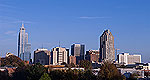
Also known as the research triangle, the three adjoining cities of Raleigh, Durham and Chapel Hill are home collectively to three major universities, some pleasant parks, a handful of good museums and big name research centers.
Located in the tobacco country of eastern North Carolina on the improved channel between Wilmington and Fayetteville, the facilities are equipped for day-use, boating and picnicking. Shad fishing is popular, but swimming and camping are not permitted.
Map + Directions
Basic Directions
Lock & Dam #3 (William O. Huske Dam) - Area is approximately 20 miles south of Fayetteville on NC 87 South. From Bladen/Cumberland County Line on NC 87: GO 2.8 miles south. Turn left onto Glengerry Hill Rd (SR 1355). Go 0.6 mile, and turn right on SR 1364 (Bill Hall Road). Proceed 1.4 miles to site. Lock & Dam #2: Site is located approximately1 mile south of Elizabethtown. From downtown Elizabethtown: Take 87 (Business) South approximately 1 mile. Turn left onto SR 1703 (Locks Road) Watch for signage. Lock & Dam #1: Site is located approximately 7 miles north of Riegelwood on NC 87. Watch for US Army Corps of Engineers signage.
We offer a compact version of Go-North-Carolina for mobile users, allowing you to access just the information you need on the road. Of course, you can still use the full version of Go-North-Carolina on your mobile device just as you can on your desktop.